Further Refined Project Descriptor

Following feedback from Wendy, I’ve simplified and focused the descriptor. I’ve got a clearer sense of the outcomes of the project in relation to the work done so far, and how the work submitted for the FMP will relate to the wider community engagement work. The relationship between this work and the wider body of work can be discussed in the Critical Review of Practice, which will include some thoughts on how the work might be developed following the MA. There is still some finessing of the text to be done (including the titling of the three components).


Beating the Bounds


Beating the bounds is an ancient English custom that, in a period that pre-dates maps, involved walking the boundaries of an area in order to remind a community of the extent of its territory through visceral experience of its natural and human markers.


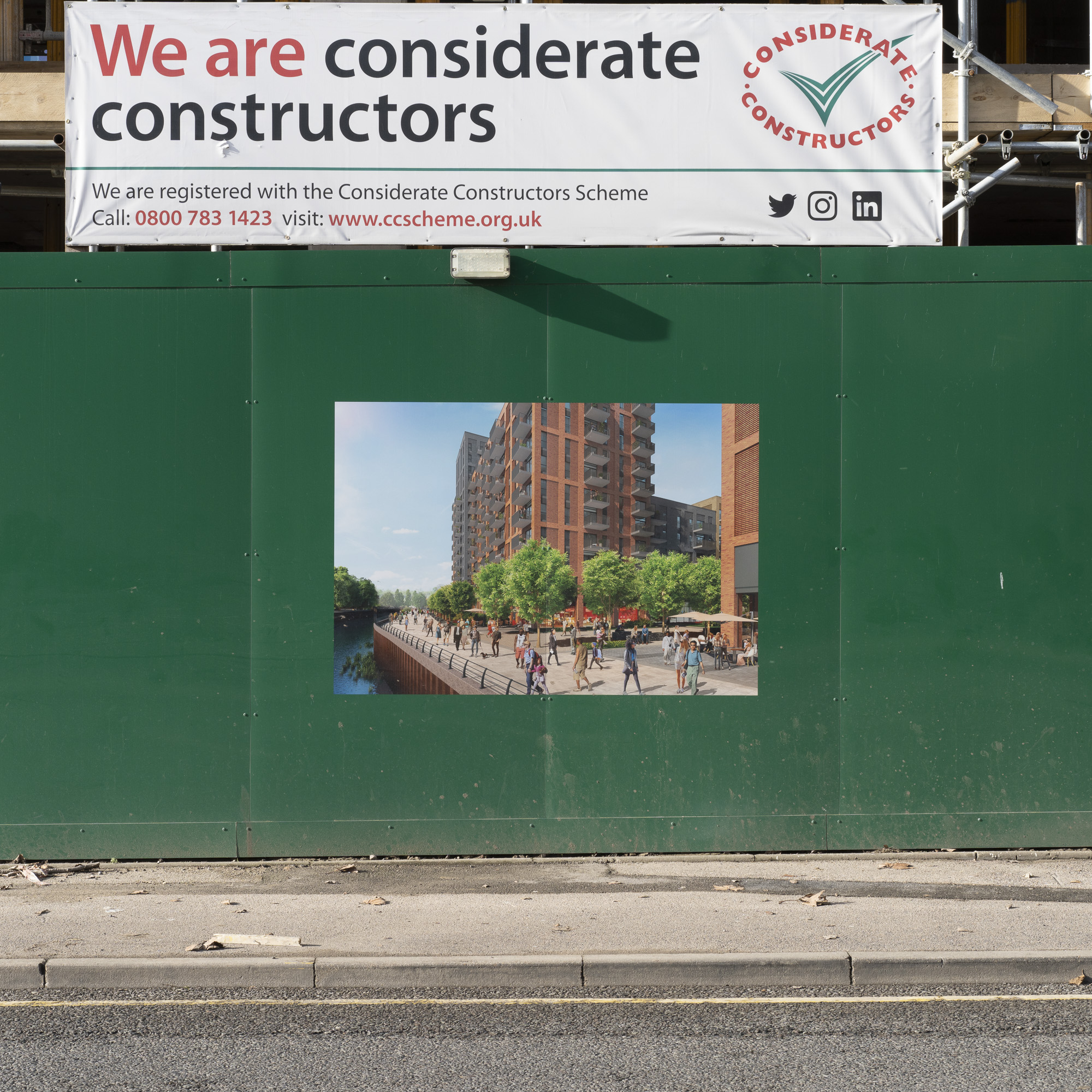
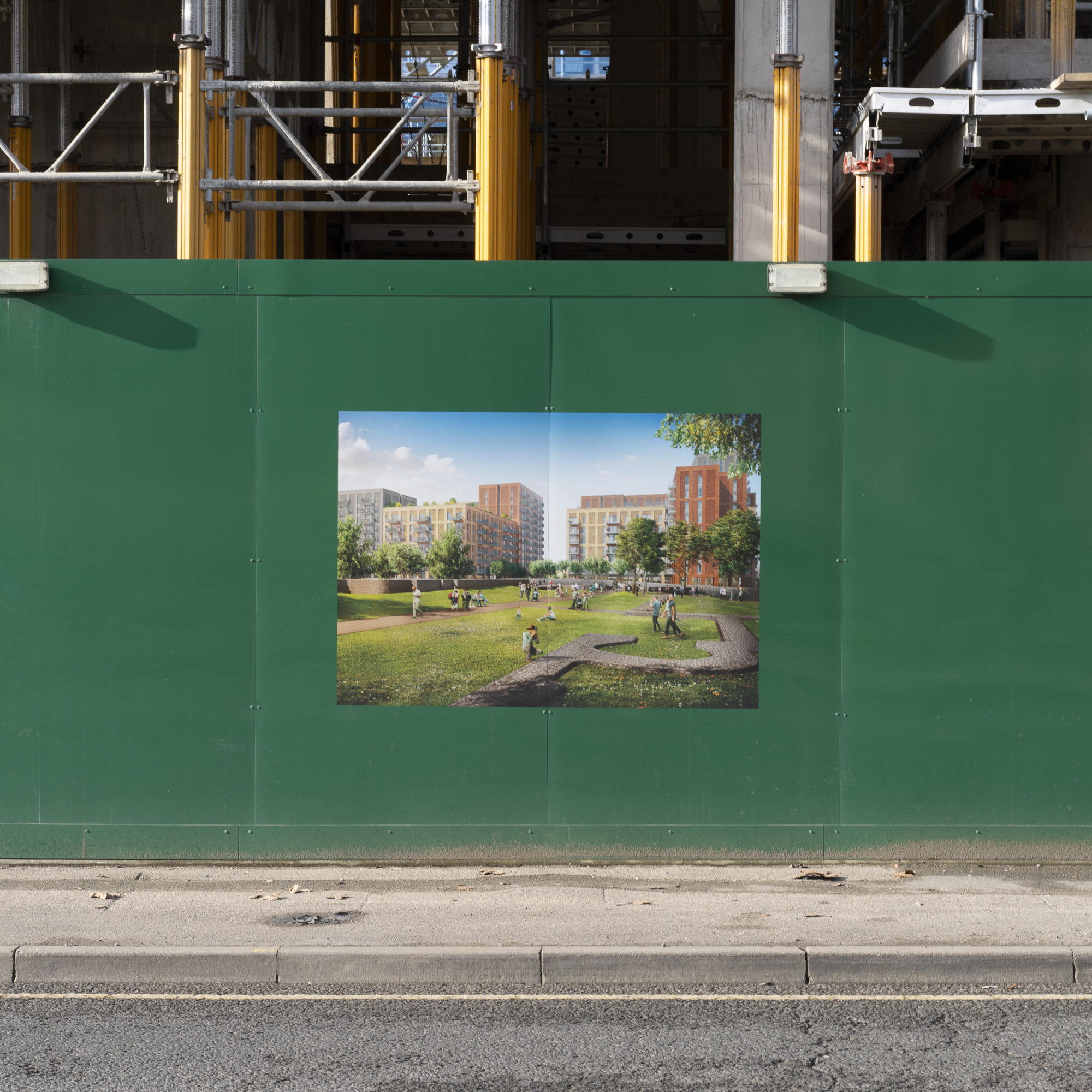
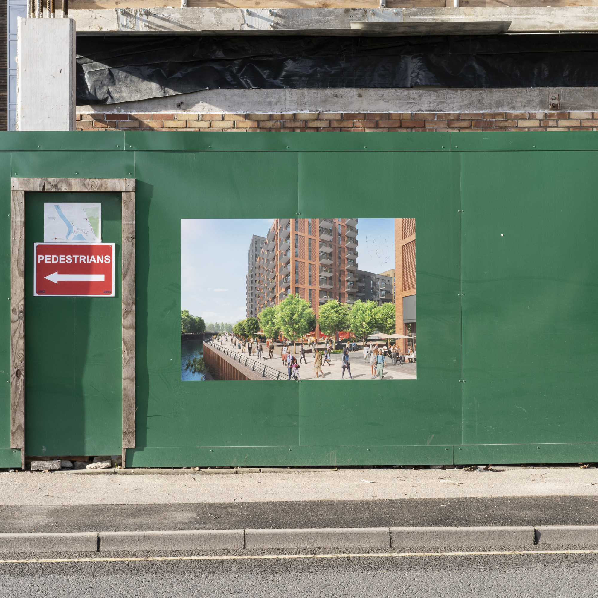
This project, inspired and informed by my community engagement activities in east London, explores three areas of rapid and extensive redevelopment in the Barking and Dagenham, London’s poorest and fastest developing borough. The urgent demand for new housing has put particular pressure on the outer boroughs of east London, optimistically referred to as the ‘rising east’. A combination of availability of disused industrial sites, neglected housing stock, social demand and aspirational local government has led to a proliferation of large-scale housing developments.

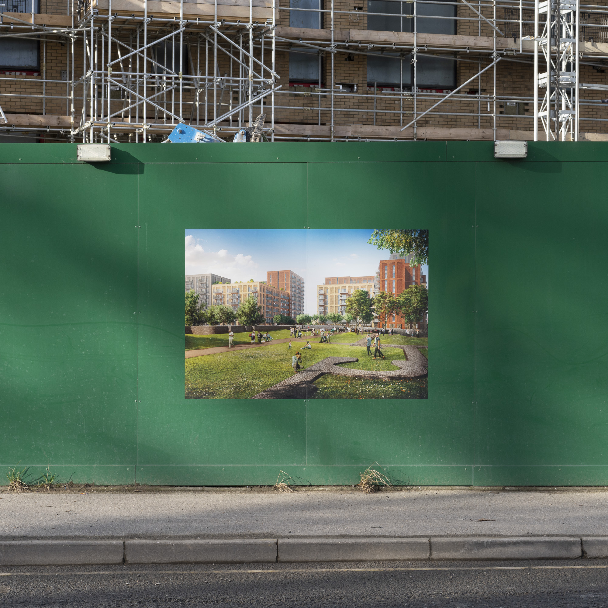
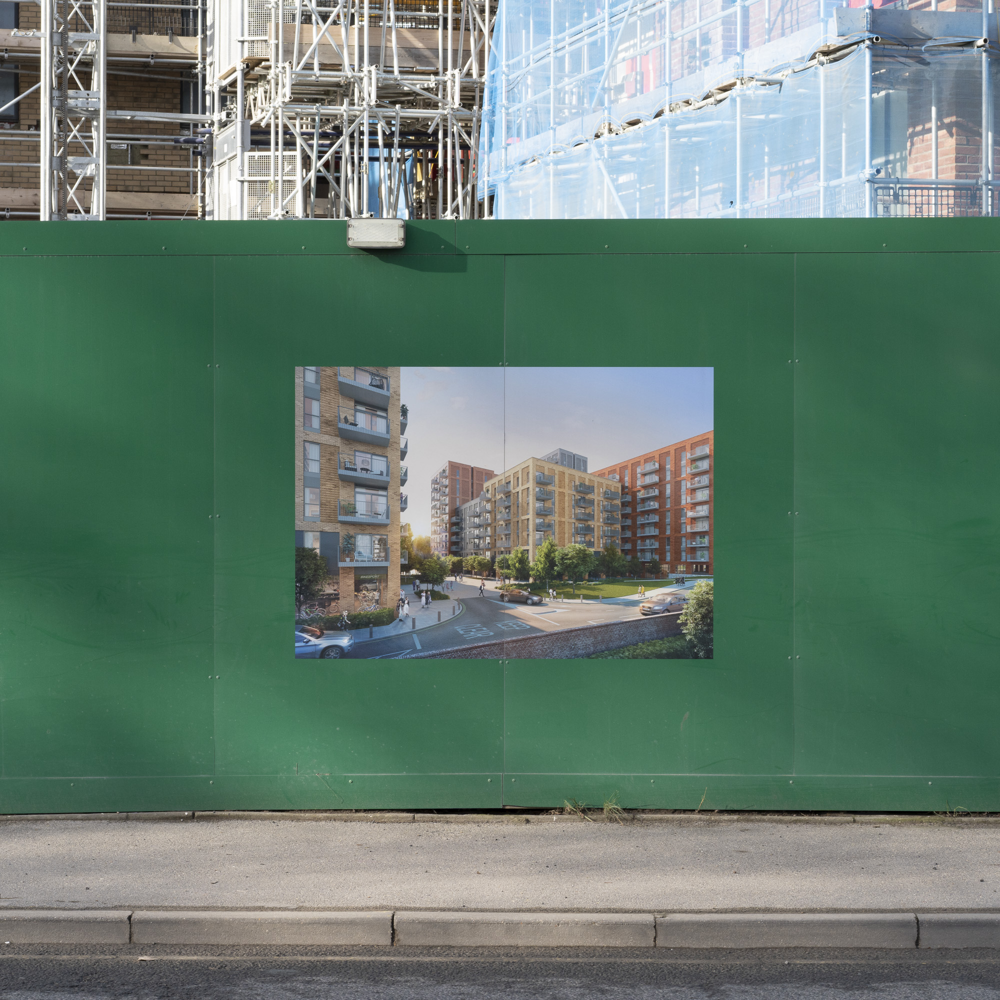
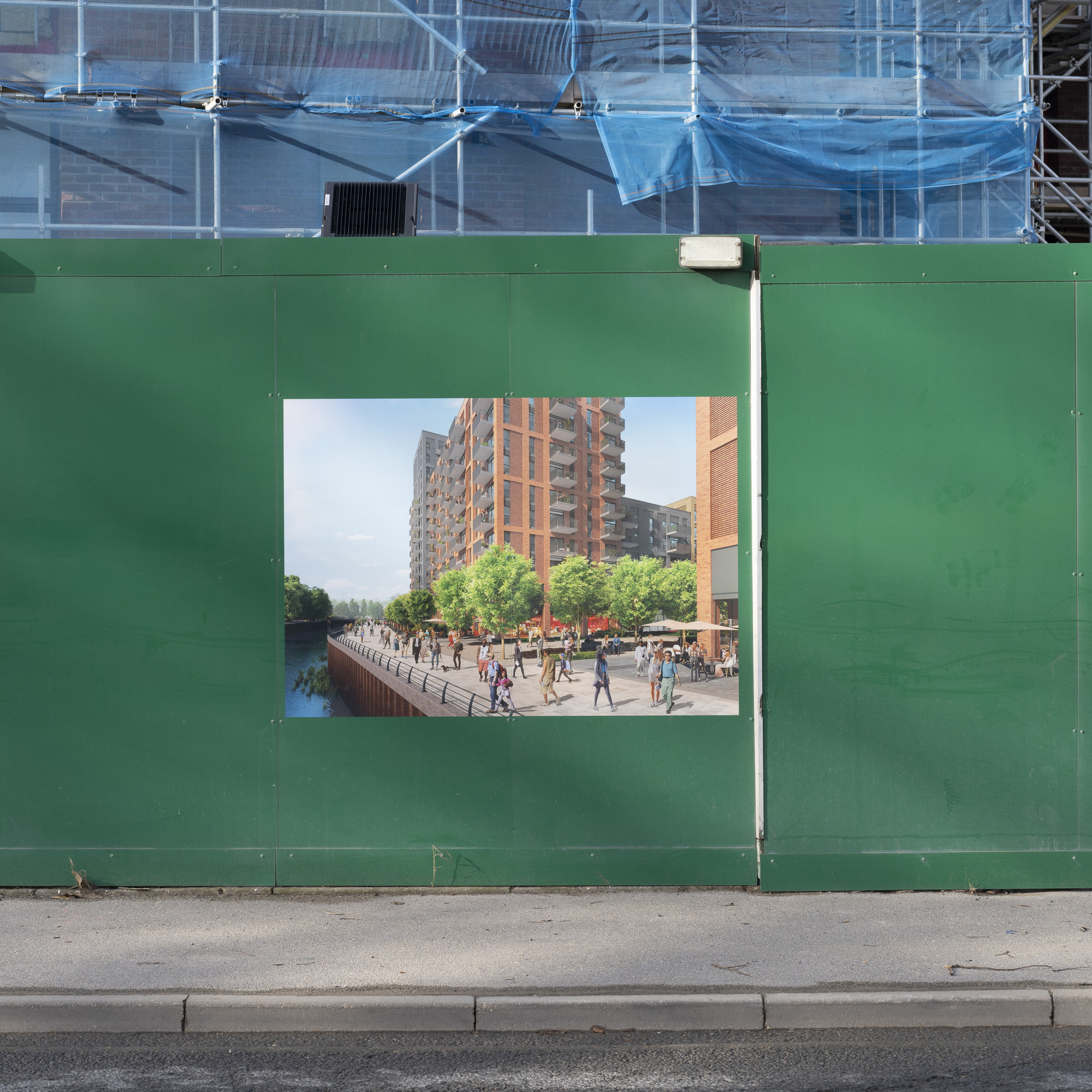
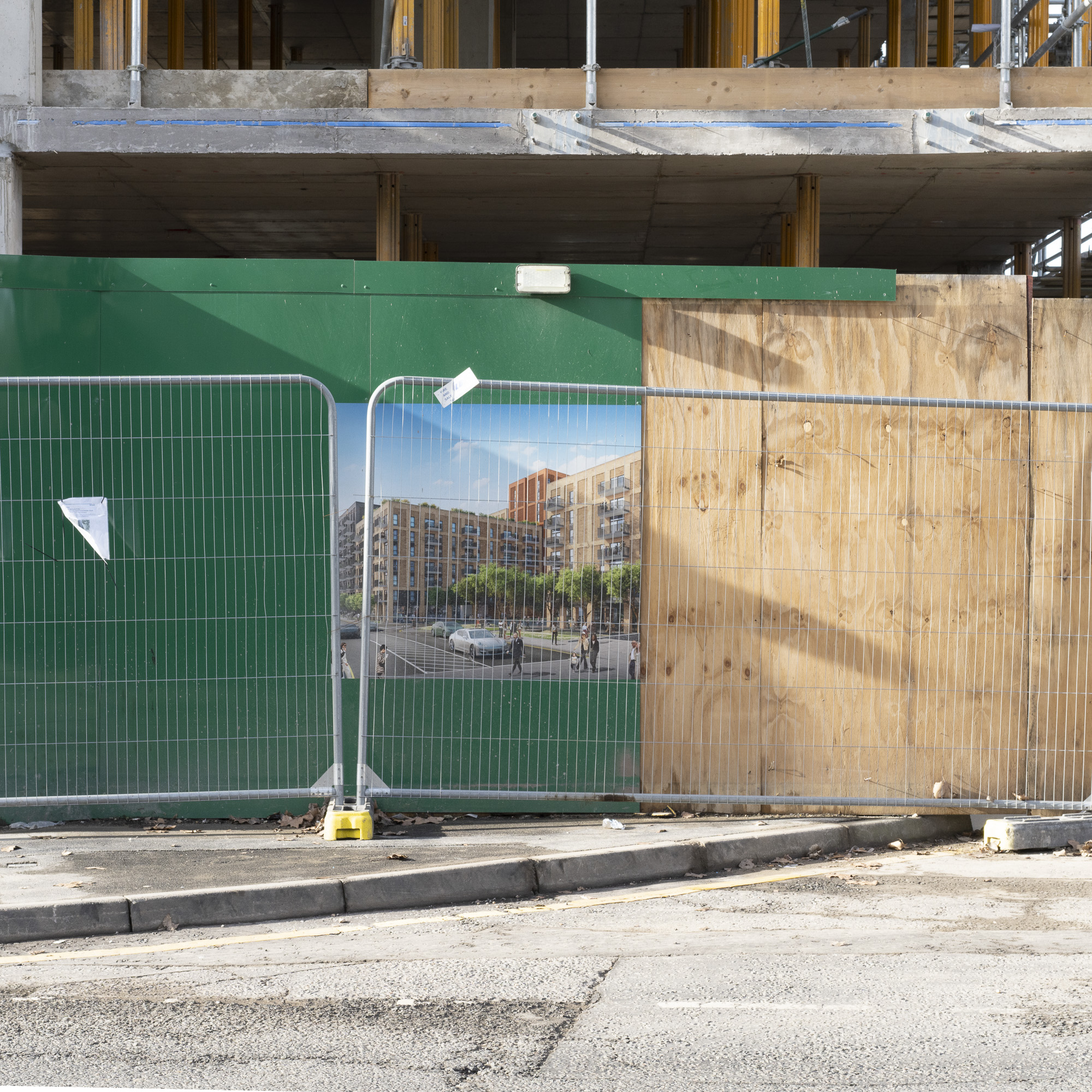
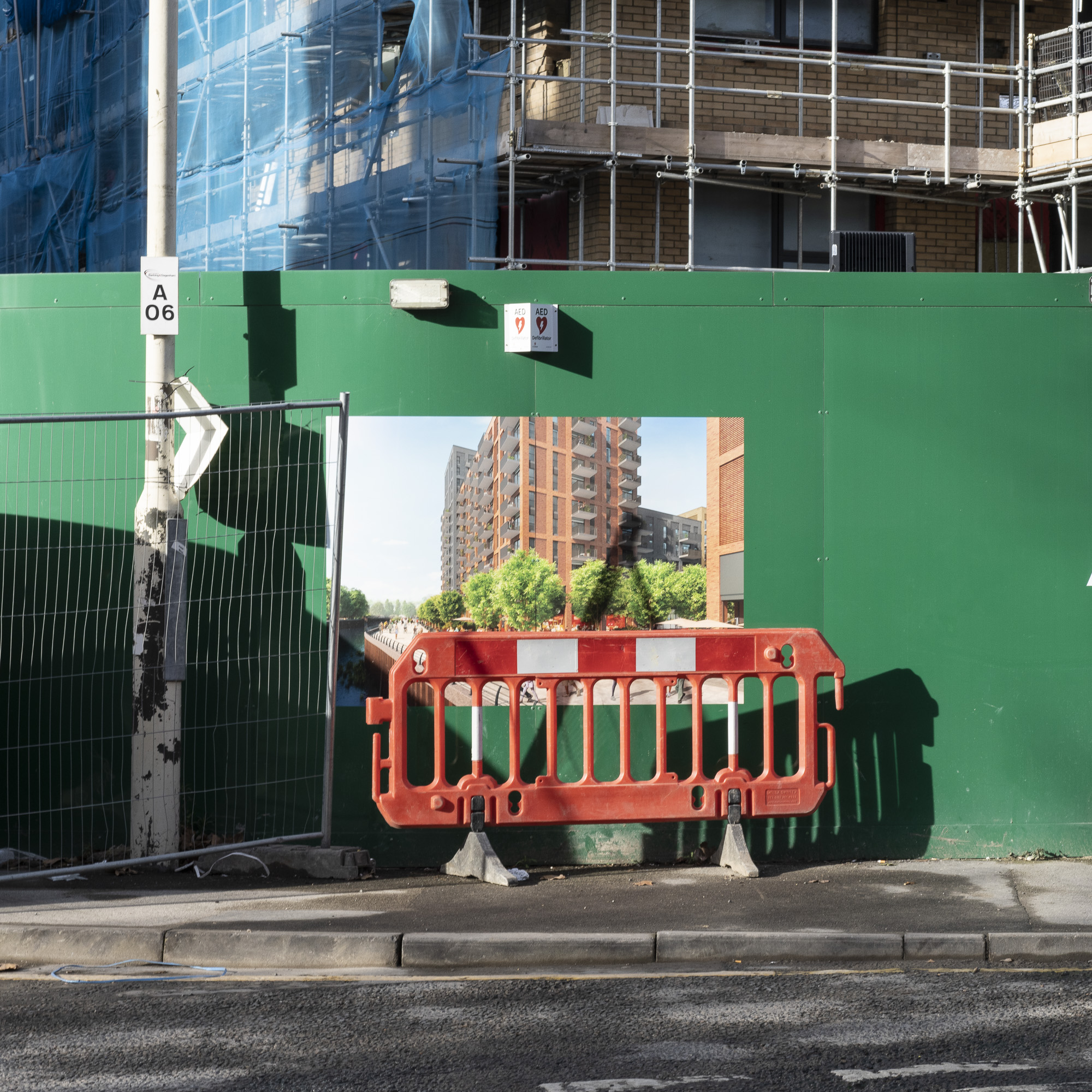
These regeneration projects have a profound impact on communities and the environment. As contested, privately owned spaces, they disrupt the relationship between community and place, severing continuity between the past and present and hopes for the future, and transform the relationship between the built and, an increasingly manicured, natural environment. The vision for the three areas presented by the developers is generic and homogeneous, and consequently dramatically out of step with the particular environmental, social and cultural characteristics of each area.

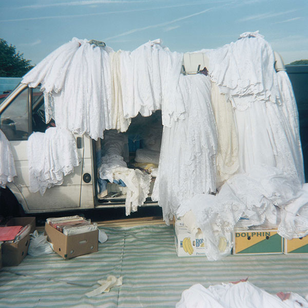
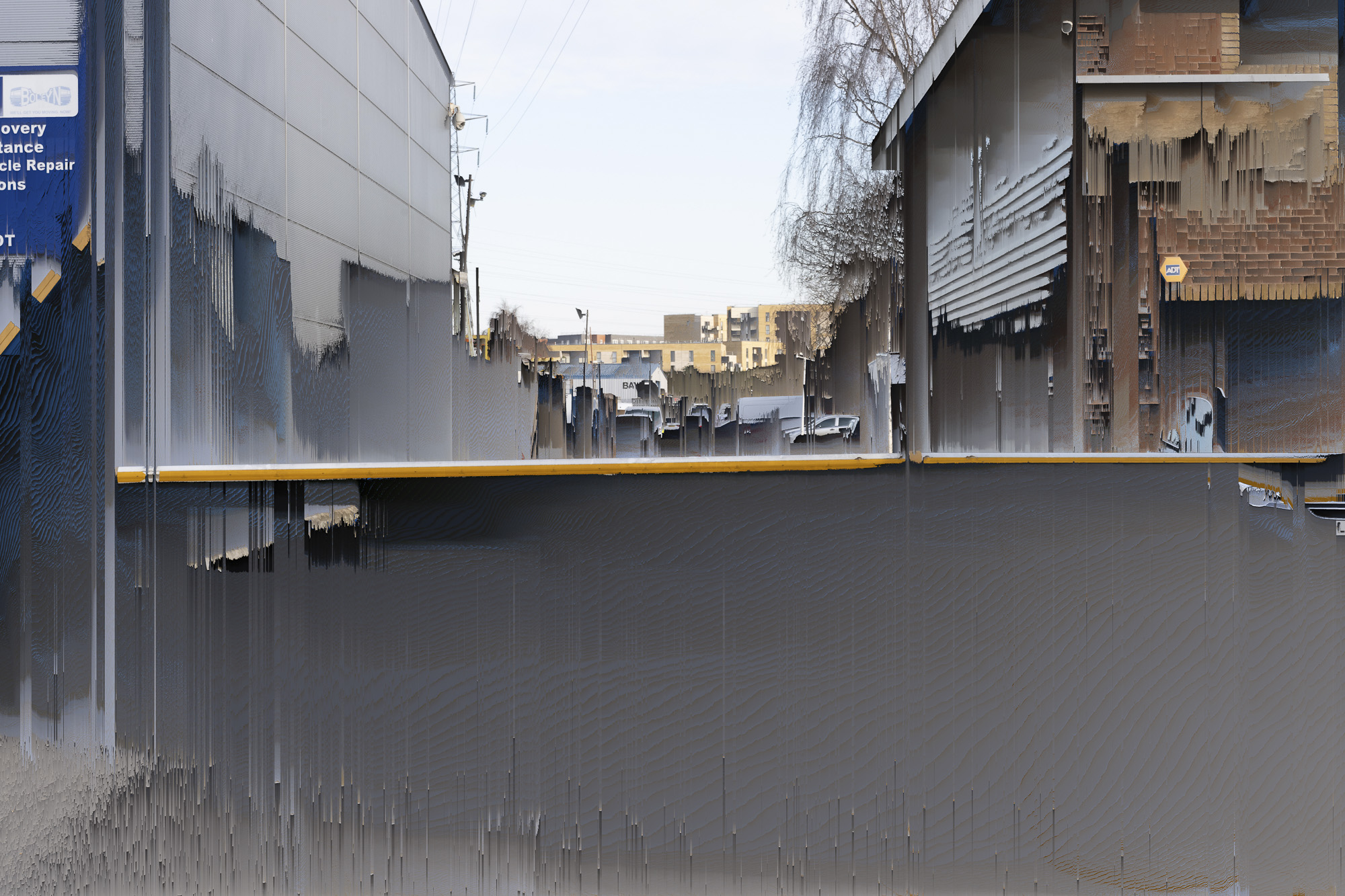
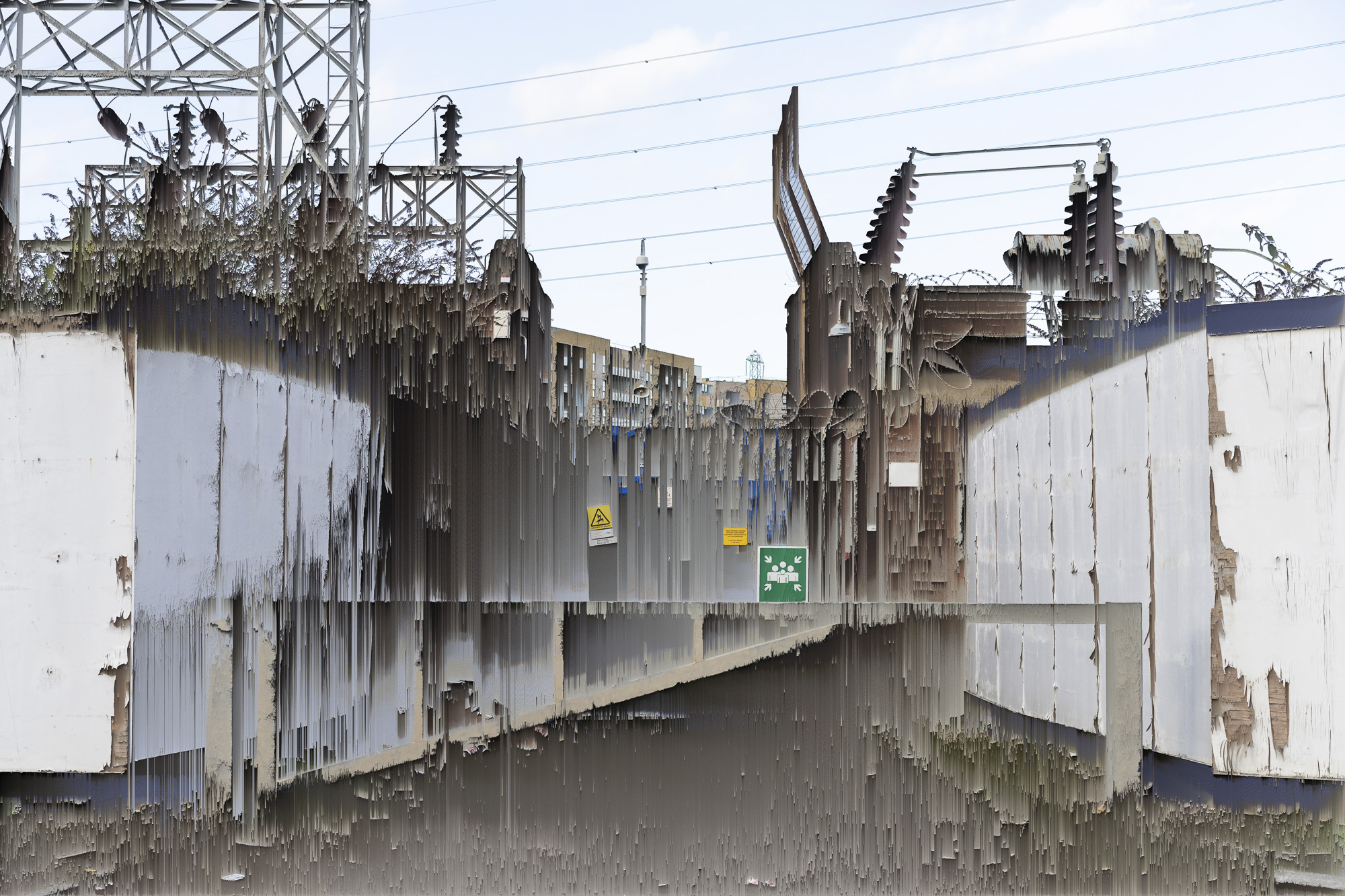
My photographic work presented for the final project visually explores aspects of this disjunction. The work is produced from images and sound recordings made, and artefacts collected, in walking the ‘bounds’ of each of the three developments. It is presented alongside contextualising materials, including maps, historical images, planning documents, text and computer-generated images.

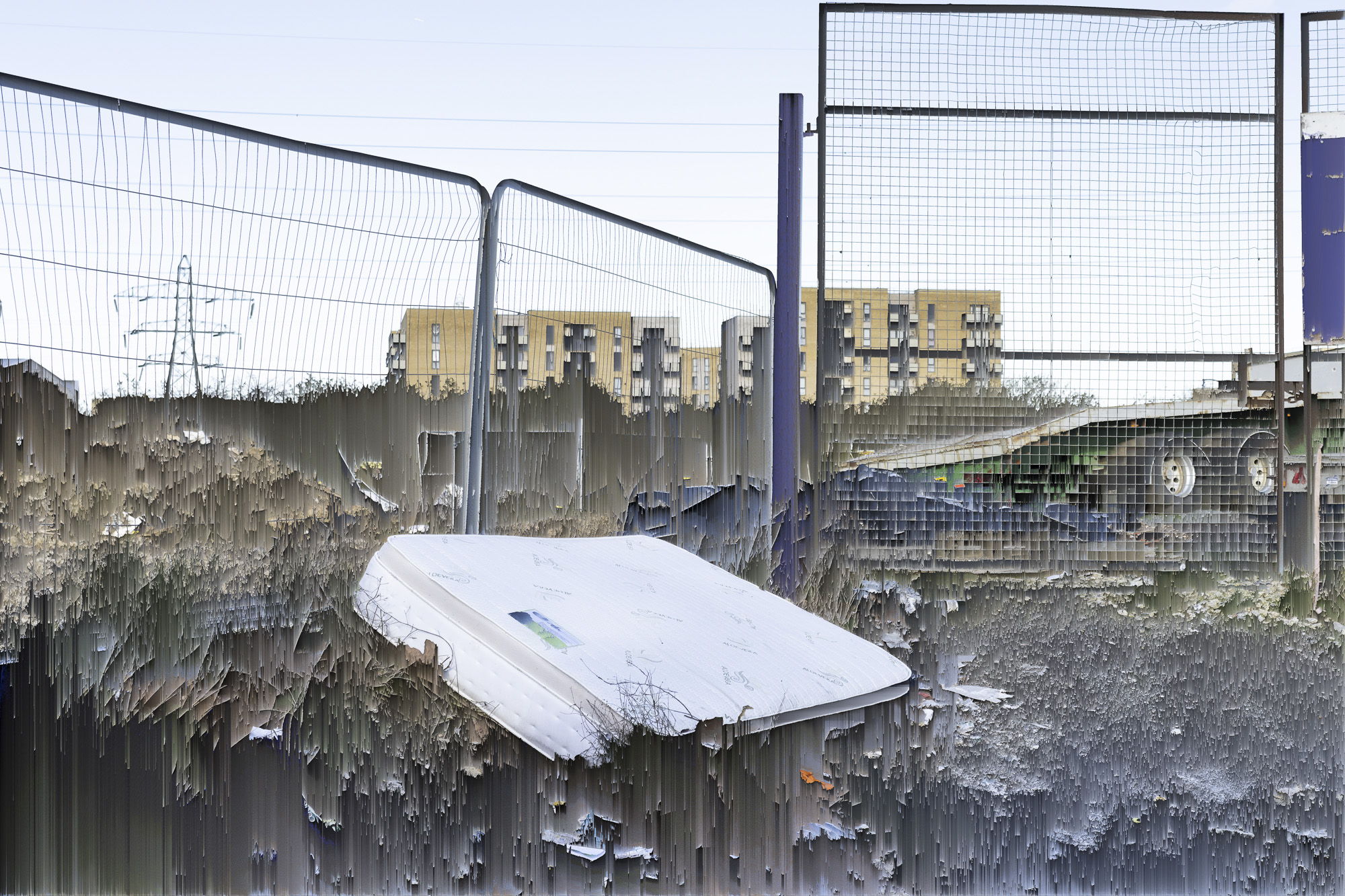
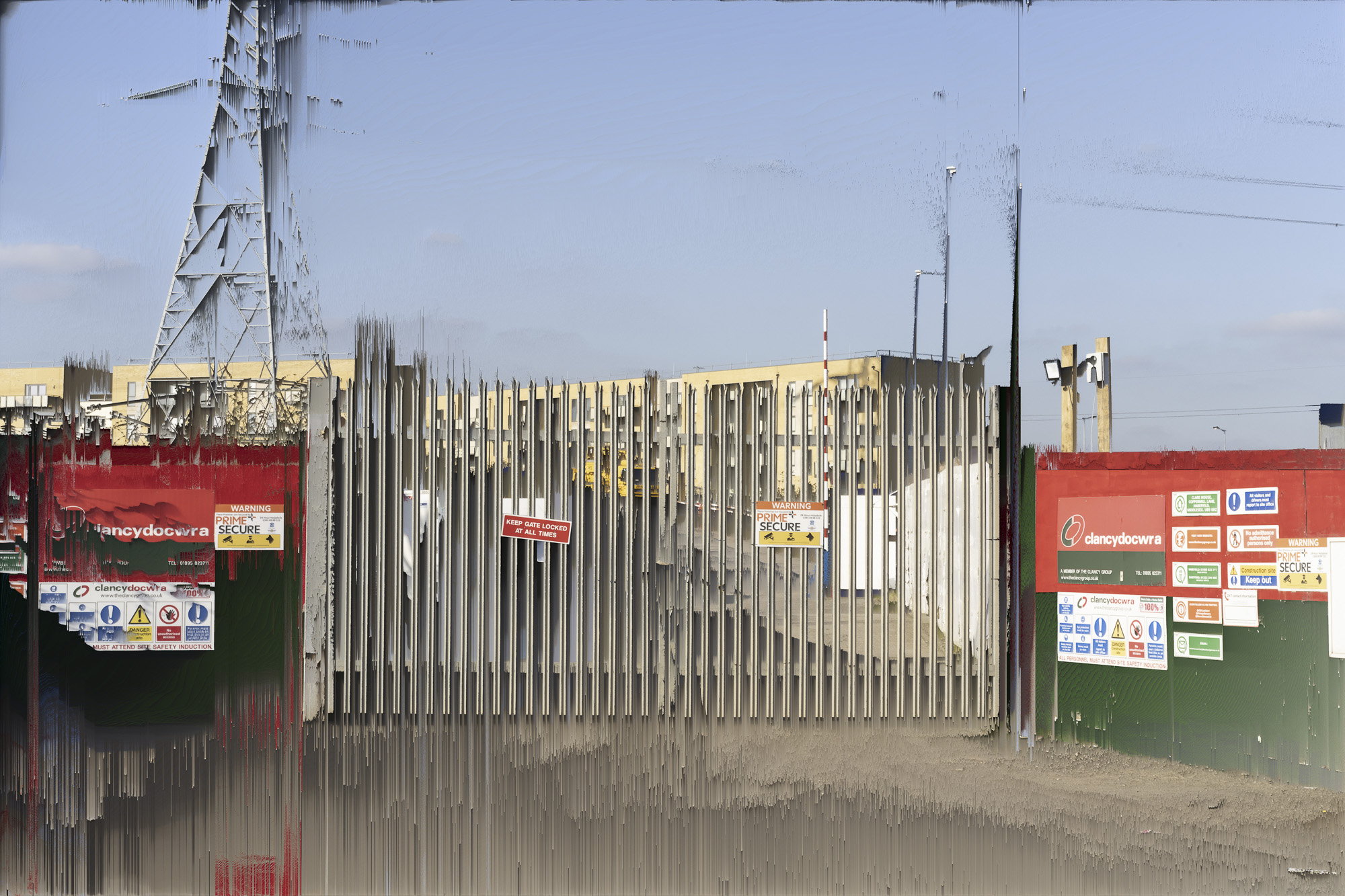
Beating the Bounds One. The town centre is a transport and retail hub that acts as a focus of activity for a diverse community. The vision of creating a ‘mini-Manhattan‘ with high rise apartments and upmarket retail outlets lies in tension with the life-worlds of current residents in one of the poorest wards of the UK. A market, dating back to the twelfth century, runs along one edge of the development area. The images explore the complex entanglement of everyday human activity with the changing natural and built environment, an entanglement neglected and negated by the CGI projected vision of the developers.

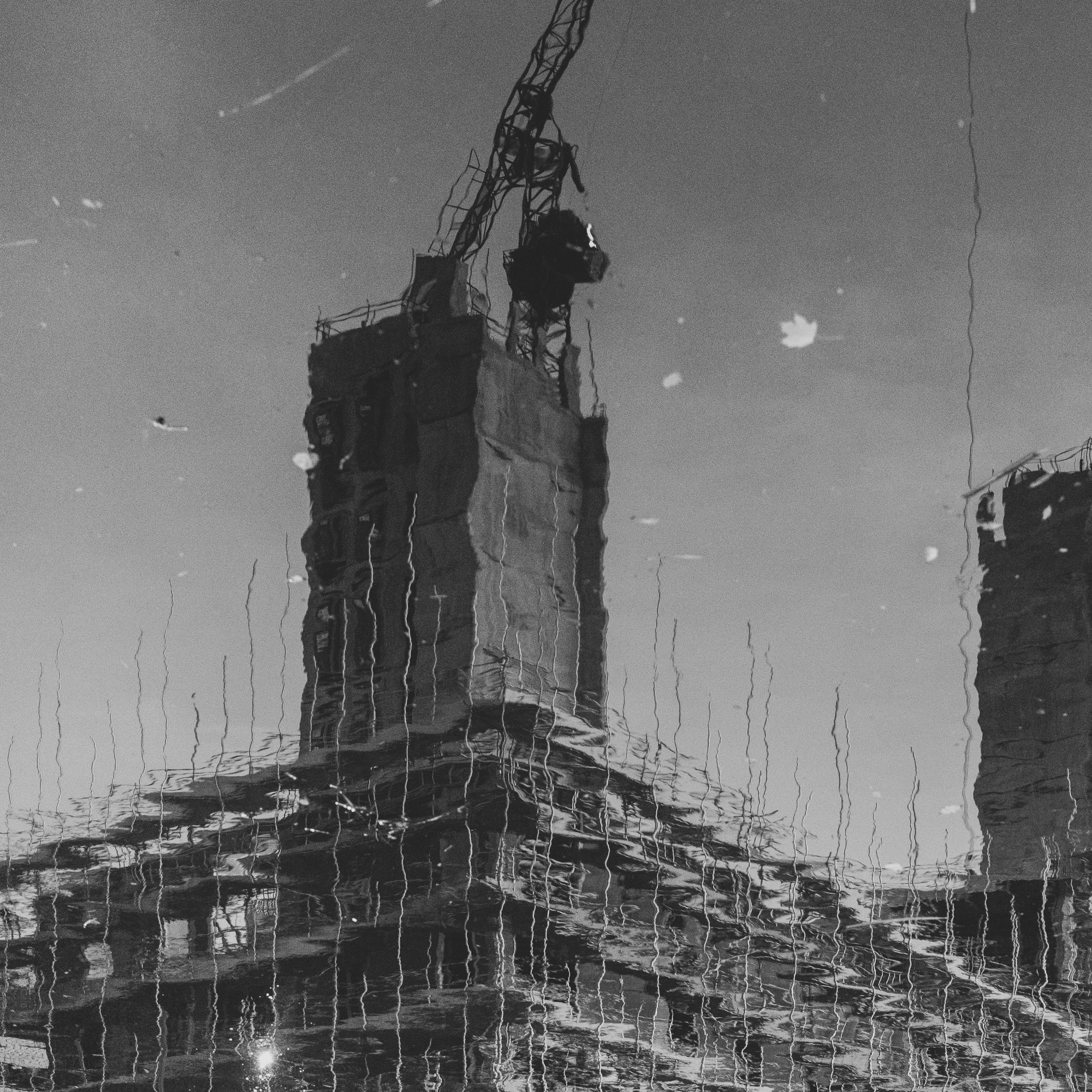
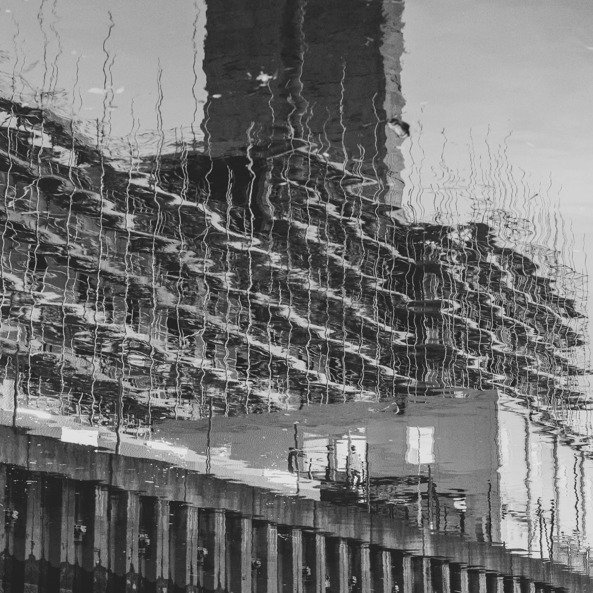
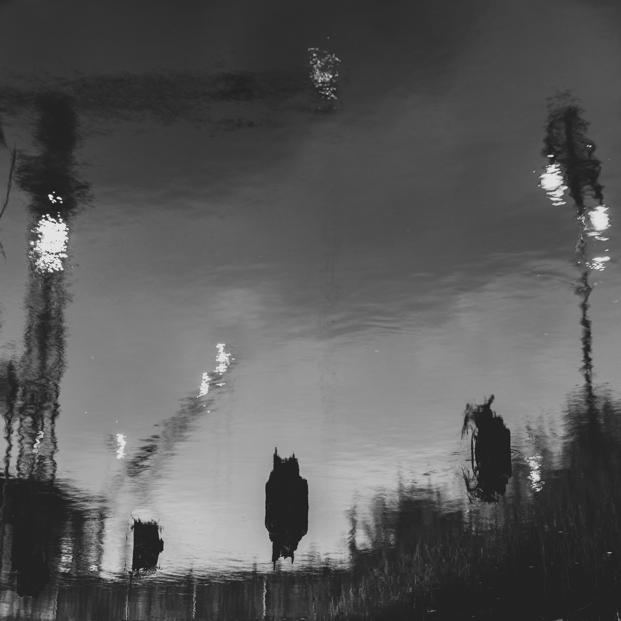
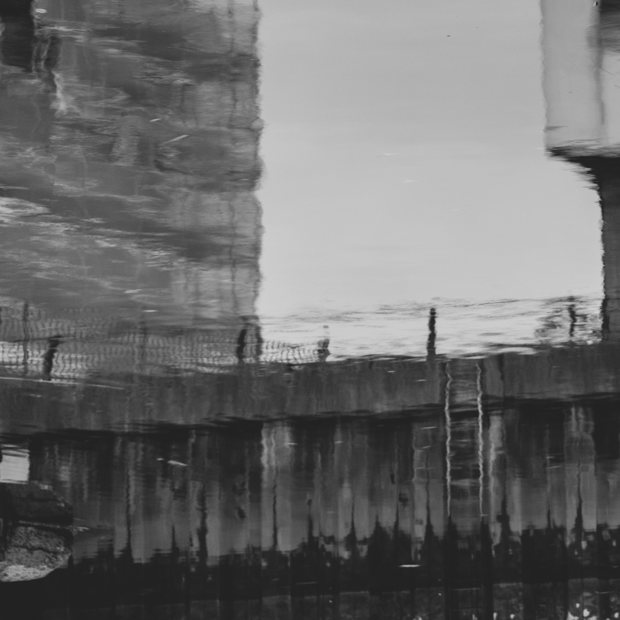
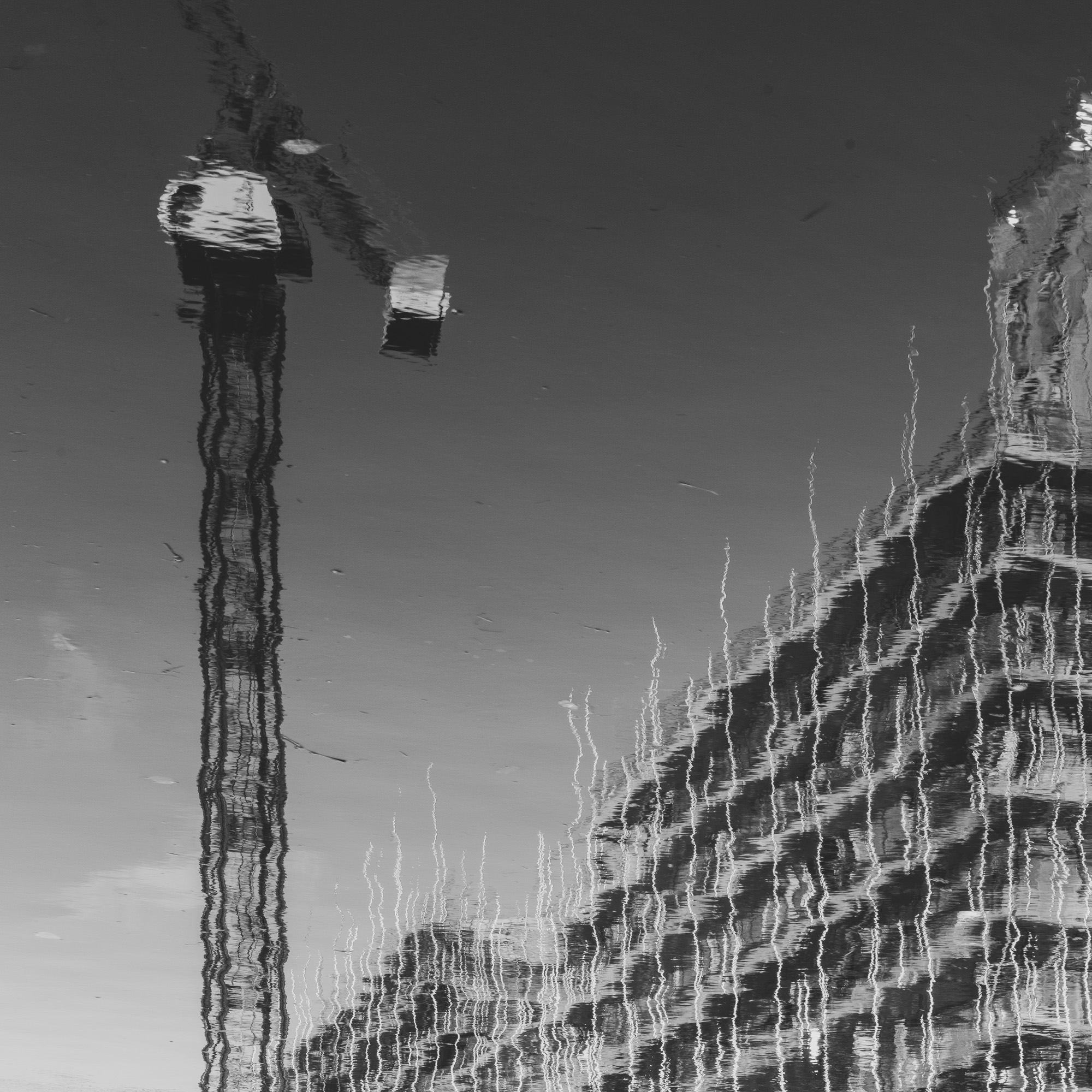
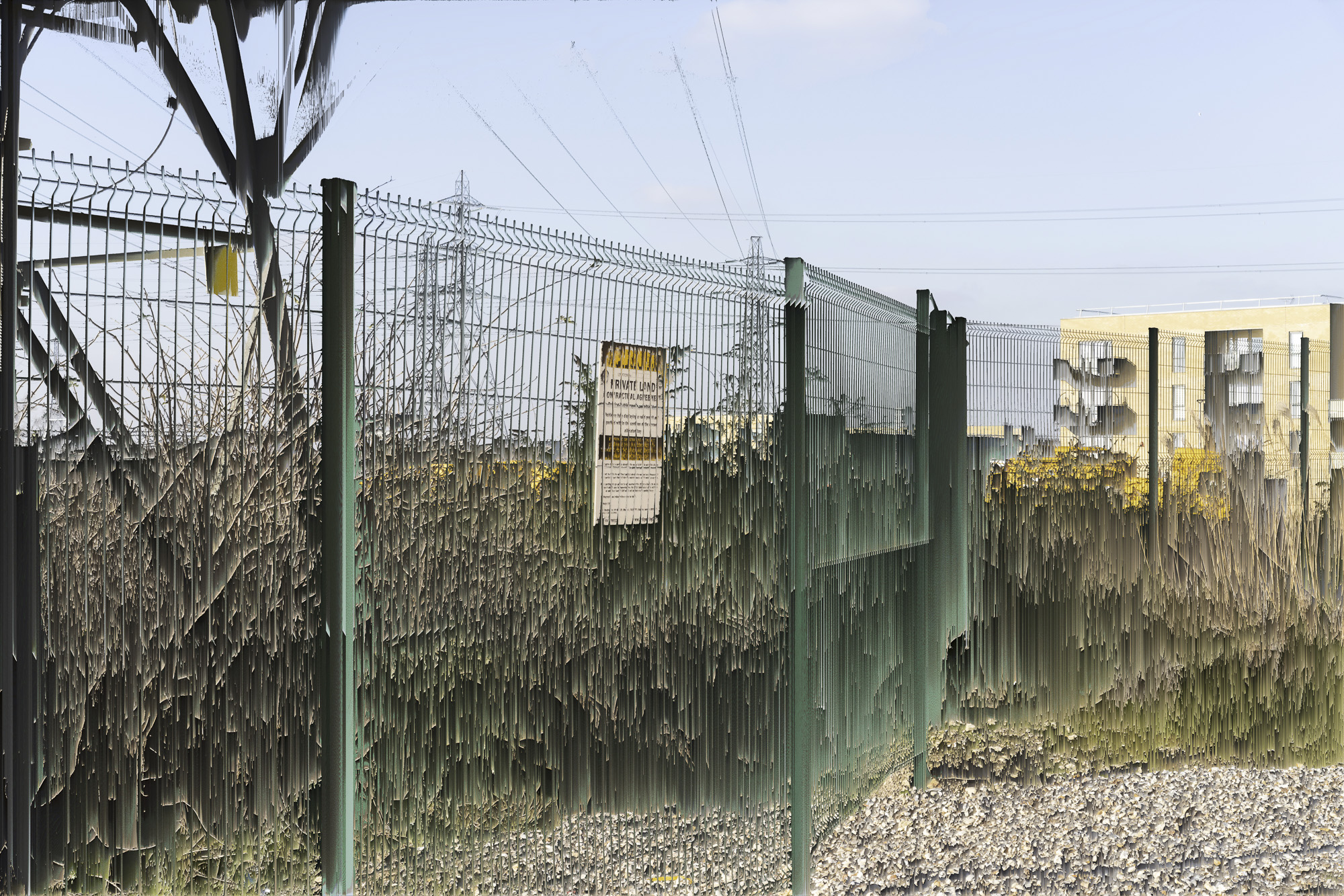
Beating the Bounds Two. Barking is an ancient parish, dating back to the seventh century. It straddles the River Roding and developed around fishing and boat building from the fourteenth to the nineteenth century, at which time it was home to England’s largest fishing fleet, the Short Blue. The industrial properties and retail parks that built up around the river following the decline of fishing are now the site of a number of large high-density housing developments, collectively referred to as the Roding Riviera. The images explore the developments reflected in the river that flows alongside them and represented on the hoardings which separate the development from a historic site along its eastern border, which includes the Church where Captain James Cook and Elizabeth Batts were married in 1762.

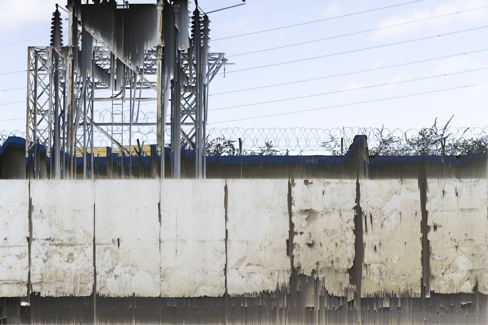
Beating the Bounds Three. The Barking Riverside development runs along the Thames and is surrounded by industrial units, scrap yards and waste processing plants. It sits on marshland adjacent to former sites of two power stations (a decommissioned gas-powered plant and an older now demolished coal-fired plant) and chemical plants, which have left high levels of pollutants in the land. This development is one of the largest in Europe, comprising of over 11,000 units, and ultimately housing a population equivalent to a city the size of Derby. The aspirations of the council leader are to create a ‘Barcelona on the Thames‘, a reference to the regeneration of the derelict industrial eastern Barcelona waterfront in preparation for and following the 1992 Olympics. In this series of images, the unruly industrial and natural periphery of the Barking Riverside development is explored through the chemical and digital degradation of images of the development, and through images made of along the boundary between the riverside public footpath and the private land of the new development.

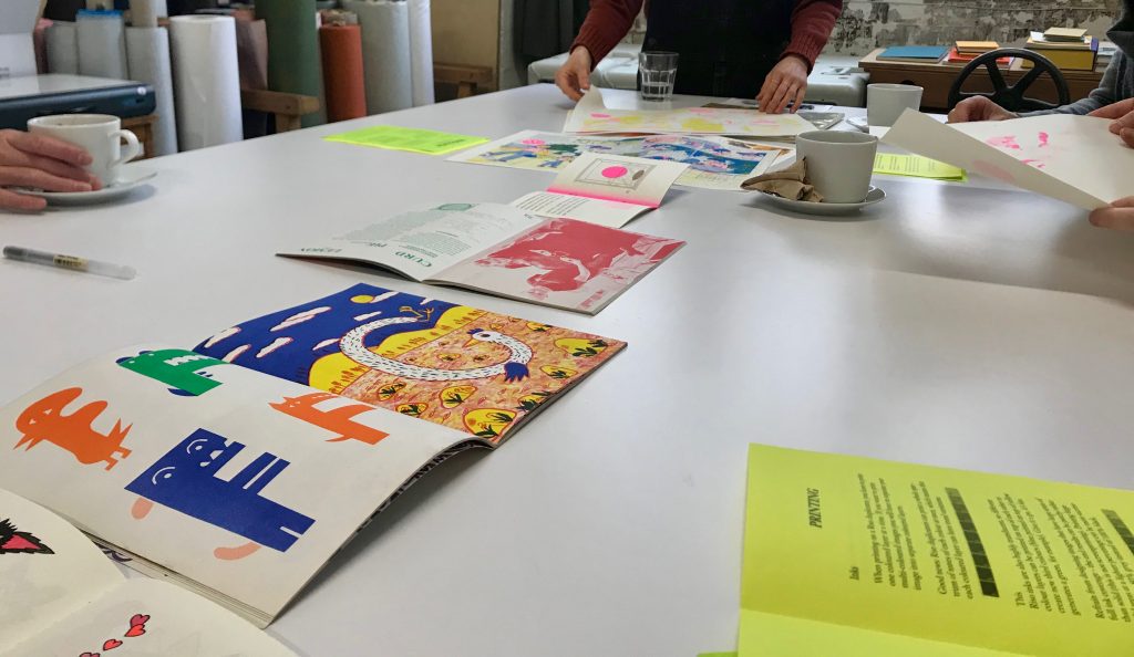
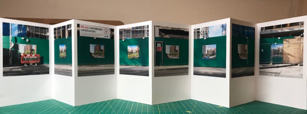
The images and materials are presented in three artist made archive boxes and can be configured and used in different ways (for instance, as an exhibition, as the basis for a group activity or for individual handling and reflection). There is no predefined order to the images or expectations about how viewing of the images should be combined with the contextual materials.  The work is non-didactic and is designed to eschew a single narrative. The sets of images are presented as a lyrical response and intended to offer the viewer the opportunity to construct their own narratives and sense of place from their engagement with the work, and, indeed, to reconfigure and add to the collections.


‘The catalyst that converts any physical location–any environment if you will–into a place, is the process of experiencing deeply. A place is a piece of the whole environment that has been claimed by feelings’.(Gussow, 1971:27)

Alan Gussow. 1971. A Sense of Place: the Artist and the American Land. San Francisco: Friends of the Earth/John Muir Institute.

Stephen Gill, Mostly Within the Area

Stephen Gill, 2011, Mostly Within the Area: Photographic projects from in and around East London, Photographers’ Gallery @ the AA, Wednesday 9 February 2011

In this talk to at the Architectural Association, Gill gives insight into his practice spanning a number of projects. My particular interest in this is the manner in which he uses visual means to explore place, and specifically areas of east London. In Hackney Wick, 2005, for instance, Gill uses a toy camera purchased at Hackney Wick market to make images of the area.

Stephen Gill, Hackney Wick series, 2005

To form an even closer link to the place itself, in Buried, 2006, and Hackney Flowers, 2007, he buries prints in the ground, leading to a degradation of the image caused by chemical interaction between the surface of the print and the soil (in a manner similar to Matthew Brandt’s soaking of prints in lake and river water; in Co-existence, 2010, Gill also immerses prints in water from the pond that is the focus for the series, and photographs local residents through pond water).

Stephen Gill, Buried series, 2006

I am exploring similar interactions between contaminated soil and chemical prints, as well as forms of digitally altering and degrading images. In Talking to Ants, 2014, Gill introduces environmental material into the body of camera, producing a combination of photogram and photograph, and introducing further chance and place related elements into the work.

Stephen Gill, Talking to Ants series, 2014

The productions of artist books, which he self-publishes, has become a core element of Gill’s practice. He is clear, however, that it is the project itself that takes priority, stating that:

‘I try to keep the picture taking stage and the book-making very, very separate. And for me it’s so dangerous, even when I’m photographing to think of a book or that series in book form. I think it’s only at the very end that I would decide. I think that is quite important for me to mention because I do make books and it’s dangerous I think if the book itself starts to steer the picture making stage so I only start editing for books when I have completely exhausted the subject or its definitely come to an end and then I tend, it’s a fine line because I try not to rush the book making process but at the same time it’s almost like you don’t want to take too long either’.

For me, the most striking feature of Gill’s practice is the tight control that he places on the scope and method of each project. The artist statements for each project are succinct, though in many cases the issues being addressed are complex. Each project has a distinct visual aesthetic identity. The roots of this way of working appear to lie in the challenge of taking London as a place as the focus of his work

‘It’s so visually overwhelming, London, and I found it very hard to pin down some of the things that I felt compelled to photograph so what I decided to do is to make these tiny subject parameters and then explore these thoroughly’.

The struggle for me has been to reign in the complexity, which is multiplied by adopting a collaborative way of working. The challenge with the FMP project is to produce a clear descriptor to orientate the viewer whilst not constraining the scope and ambition of the work.

References

Gill, S. 2006. Buried. London: Nobody Books.
Gill, S. 2010. Co-existence. London: Nobody Books.
Gill, S. 2007. Hackney Flowers. London: Nobody Books.
Gill, S. 2005. Hackney Wick. London: Nobody Books.
Gill, S. 2011. Mostly Within the Area: Photographic projects from in and around East London, Photographers’ Gallery @ the AA, Wednesday 9 February 2011. https://www.aaschool.ac.uk/VIDEO/lecture.php?ID=1340
Gill, S. 2017. Talking to Ants. London: Nobody Books.

Risograph printing

London Centre for Book Arts, 22nd February 2020

Half day session at the London Centre for Book Arts. Had the opportunity to talk through ideas for constructing my archive boxes for the FMP with people there, as well as learning about and experimenting with Risograph printing. Lots of potential for producing vibrant colour work at volume for a reasonable price (cutting a stencil costs £1.50, ink costs £1.50 for 50 sheets, provide your own paper). Could be useful for outputs from community focused work, and in particular production of posters, zines and books (paper up to A3, and can scale up). Not sure whether this is something I would use for the FMP as it is currently conceived, though people have used it for reproduction of photographic work (see work by Christine, who has produced a case bound book combining letterpress with risograph – see test prints below).

We worked from original and found artwork, but it is also possible to work with digital files (though the software for this is dated). Useful tips for using risograph printing at http://stencil.wiki/

Revised Project Descriptor: Beating the Bounds in the Rising East

The urgent demand for new housing has put particular pressure on the outer boroughs of east London, where a combination of availability of disused industrial sites, neglected housing stock, social demand and aspirational local government has led to a proliferation of large-scale housing developments. These regeneration projects have dramatic impact on both the environment, and local communities. 

This project (which is part of a wider engagement with community and activist groups) uses visual means to explore and convey a personal emotional response to the impact of three major developments in Barking and Dagenham, which is both the poorest and the most rapidly developing borough in London. The first of these is the transformation of Barking town centre, through an ambitious, but fragmented, mix of high rise housing and new retail outlets, described by the leader of the council as the creation of a ‘mini-Manhattan’. The second is a strip of large high density developments along the River Roding, transforming moribund retail and industrial parks into ‘the Roding Riviera’. The third development, Barking Riverside, runs along the Thames and is surrounded by industrial units, scrap yards and waste processing plants. It sits on marshland adjacent to former sites of two power stations (a decommissioned gas-powered plant and an older demolished coal-fired plant) and chemical plants, which have left high levels of pollutants in the land. This development is one of the largest in Europe, comprising of over 11,000 units, and ultimately housing a population equivalent to a city the size of Derby. The aspirations of the council leader are to create a ‘Barcelona on the Thames’, a reference to the regeneration of the derelict industrial eastern Barcelona waterfront in preparation for and following the 1992 Olympics.

Whilst the wider project address questions of social infrastructure and community empowerment, the work presented for the FMP specifically focuses on the relationship between human activity and the natural and built environment, and our relationship with the land. The principal images result from walks around the perimeters of the developments (all of which are on private land),  informed by engagement with community and activist groups and archive work; a contemporary form of the ancient practice of ‘beating the bounds’ in which the boundaries of an area are physically experienced, re-established and committed to memory. The images combine elements of human activity and the environment in different ways. The use of analogue and digital forms of image making, processing and distribution reflect the transition from material/chemical to symbolic/digital production in the area (the site of a large chemical plant, for instance, now houses one of Europe’s largest data centres, and an electricity substation built to serve its power requirements). The play between digital and analogue forms also resonates with the impact on the environment and the lived experience of citizens of ‘datafication’ and use of algorithms in social planning and development. The area has strong links to China, and is the UK terminus for ‘the new silk road’, with a train from Yiwu in northern China arriving once a week with 34 containers, following an 18 day journey, adding a further dimension to the the notion of the borough as ‘the rising east’ and raising questions about where the boundaries for an area can be drawn.

The outcomes of the project are in the form of three sets of images with contextual material (texts, maps, diagrams, sound recordings and artefacts), which together serve to provoke engagement with different dimensions of the impact of rapid urban development on this area of east London, and more widely. The images and materials are presented in three artist made archive boxes, and can be configured and used in different ways (for instance, as an exhibition, as the basis for a group activity or for individual handling and reflection). There is no predefined order to the images or expectations about how viewing of the images should be combined with the contextual materials.  The work is non-didactic, and is designed to eschew conveying a single narrative. Rather, the sets of images are presented as a lyrical response, and designed to offer the viewer the opportunity to construct their own narratives and sense of place from their engagement with the work, and, indeed, to reconfigure and add to the collections. 

The photographs in the ‘mini-Manhattan’ collection combine images of everyday human activity in the area with images of the natural environment and the process of transformation of the built environment. The ‘Roding Riviera’ photographs use the river as an enduring form of mediation of images of construction and environmental transformation. In the ‘Barcelona on the Thames’ series, the unruly industrial and natural periphery of the Barking Riverside development is explored through the chemical and digital degradation of images of the development. In each case, the principal images are juxtaposed with a range of contextual contemporary and historic images and other material.

The work will be presented publicly in a sequence of pop-up exhibitions, workshops and presentations, including an exhibition (5th March) and a trade school on community archiving (9th April) at the Participatory City Warehouse in the Barking Riverside area, a series of workshops (5th, 10th and 25th March) and an Open Table exhibition (18th April) at Everyone Everyday in Barking town centre, and a presentation to the London Prosperity Board (29th April).

Barcelona on the Thames – glitched

Some of the results of running the Processing 3 pixel sorting procedure on images from the periphery of the Riverside development. Interesting how the structure of the Riverside blocks leaves them almost unaltered by the sorting process. Had to experiment with the sorting thresholds for each image. In all cases, the sorting is in columns by the whiteness of the pixels (with the threshold set at around 300 to 600).

Vincent Desailly, The Trap book launch

31st January 2020. The Photobook Cafe, London EC1.

Interesting to talk to Vincent about the project and process of producing the book. He’s known as a portrait photographer, and has an image in the 2018 Taylor Wessing Photographic Portrait Prize exhibition (see below – also from The Trap).

Vincent Desailly, Red Dawn, 2018

It took three trips to Atlanta to complete the project. He was disappointed with the images from the first trip, principally because they were predominantly portraits which gave little sense of the distinct context (as he observed, they could have been taken in London). The images from the next two trips convey much more of the context and the relationship between people and place. For the editing and sequencing the images, he worked with an editor who asked to look at all of the images, and some images (including the cover image) were included in the final edit that had initially been rejected (this reinforces the importance of working with an experienced editor). It is interesting to see the manner in which images, which may not seem strong in their own right, can form effective bridges and transitions between other images. I particularly like the manner in which maps, on tracing paper, are included in the text, further emphasizing the importance of place in this particular project.

References

Desailly, V. 2019. The Trap. Edited by Hatje Cantz – 51 pictures, 128 pages, English text, introduction by Gucci Mane. https://www.vincent-desailly.com/

TWCP exhibition at the Warehouse

3rd February 2020. TWCP 4th Resident Growth Summit, The Warehouse, Thames Road, Barking.

This gave me the opportunity to try out the idea of a rapid set up (and demount) exhibition, and to show the work I have produced with the Thames Ward Community Project. In total there were 120 prints, which took a week to produce and mount. Putting the work up took about four hours, mainly because pieces had to be clipped to each other to adapt to the space. I feel more confident about exhibiting in these kinds of challenging spaces, and being able to put together sets of images and other resources that can be displayed effectively and quickly.

The exhibition was easily taken down and stored at the end of the day. I need to produced appropriate storage boxes for the mounted images and the materials needed to put together the display. I am not going to use any of these images for my final project, though the work I have done with TWCP will influence the form and content of the work and the manner in which it will be presented to an audience, and the exhibition is part of a sequence of project engagement activities. I’ll write about this in the Critical Review of Practice.